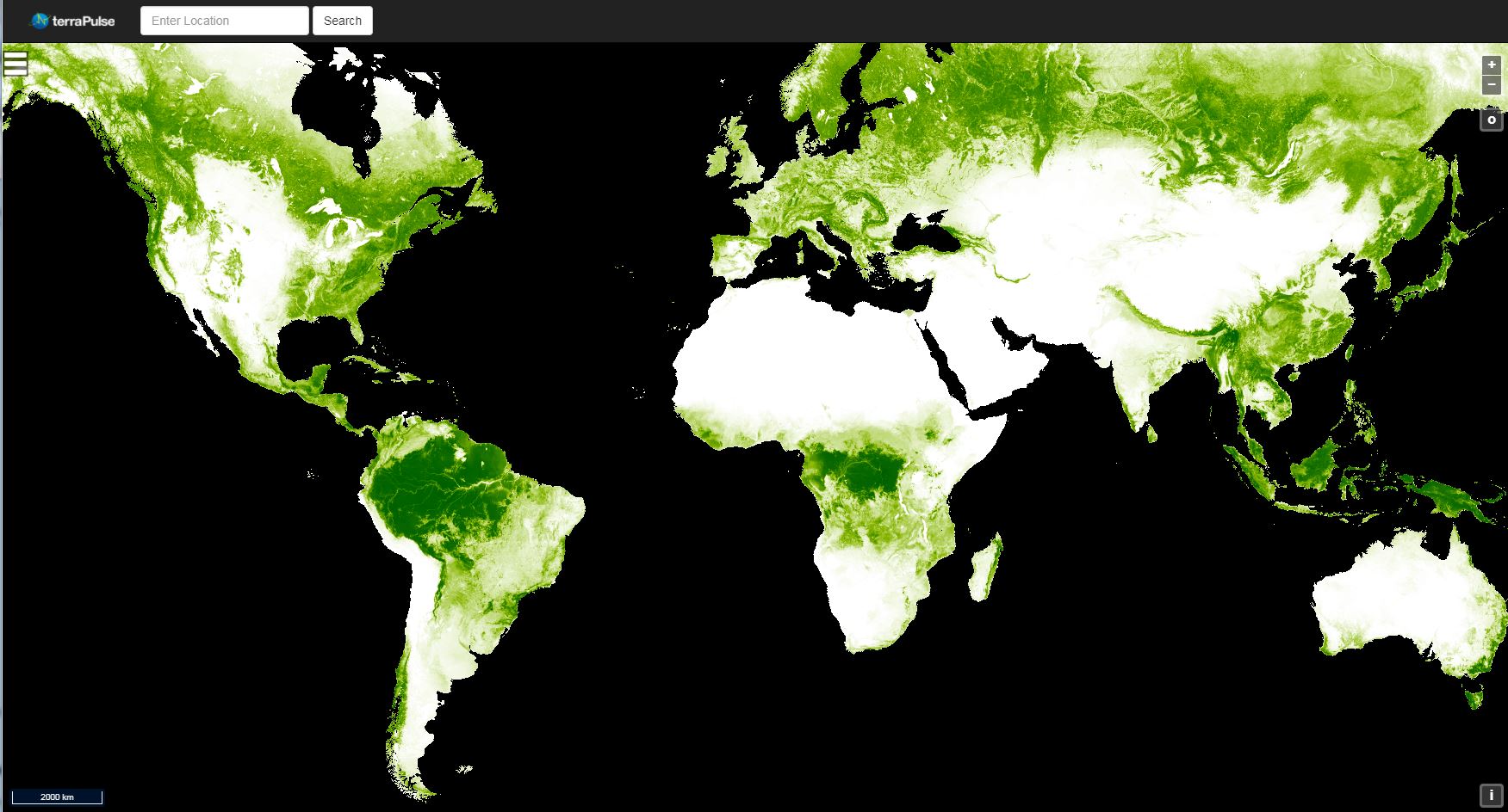
Global 30m Landsat Tree Canopy Version 4 Released
This latest version was created by mining and processing the entire Landsat archive.

This latest version was created by mining and processing the entire Landsat archive.

Some Landsat-focused excerpts from Garik Gutman’s March 2019 message to the LCLUC team.

Thomas managed the development of early Landsat image processing software systems and became the resident expert on the Computer Compatible Tapes that were used to store early Landsat imagery.
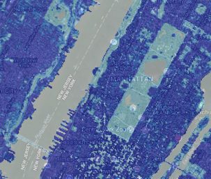
Two new Landsat-based data products and a mapping tool provide data on man-made impervious surfaces and urban extents throughout the world.
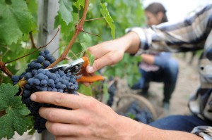
Evolving technology, free data and robust calibration have helped make Landsat the cornerstone of global land imaging.
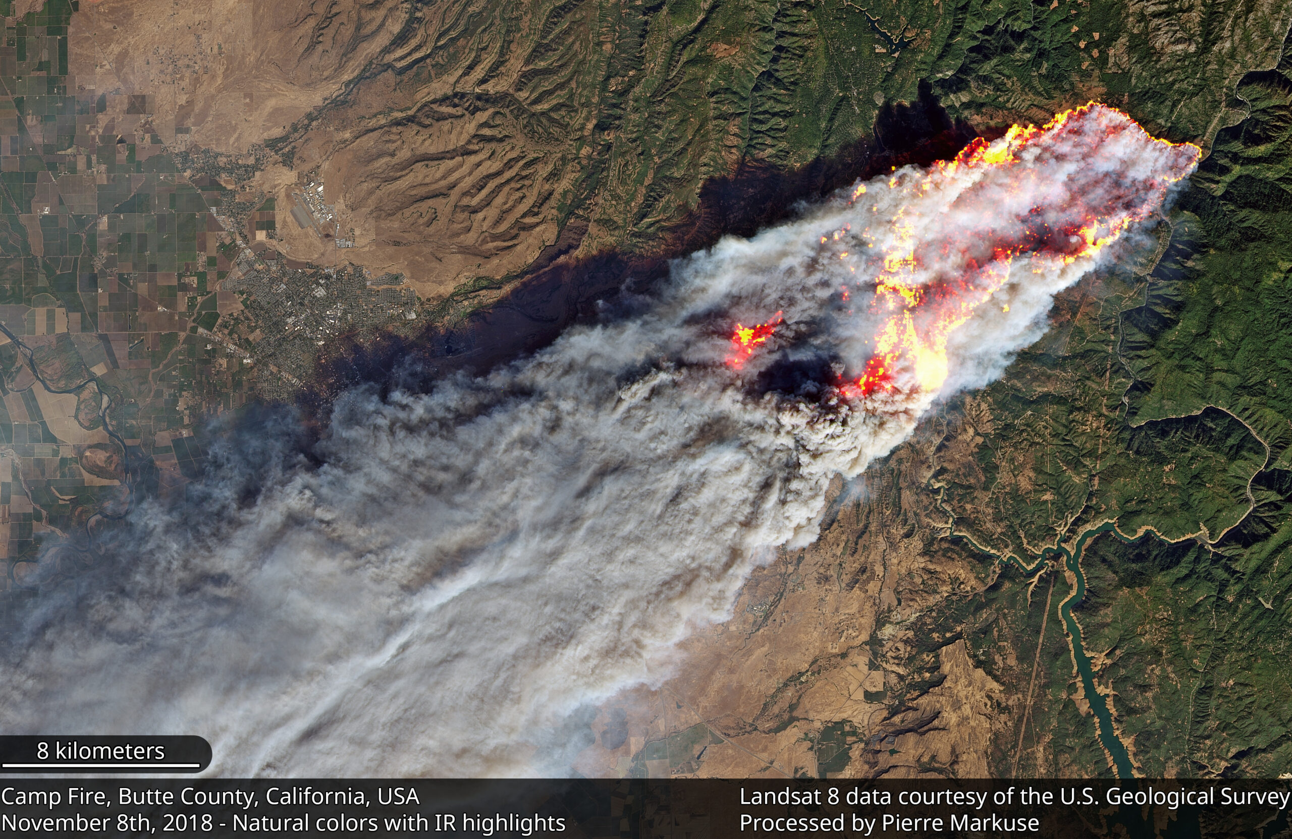
Sprawling urban fires that once plagued civilization were thought to be a thing the past—the Camp Fire let us know they are back.

C.J. Loria will oversee Landsat satellite and Earth imaging operations.
Landsat 9 Ground System development team members executed the first of a series of Ground Readiness Tests this week.
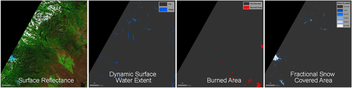
The USGS has developed research-quality, applications-ready, Landsat Level-3 Science Products that are now available for download from EarthExplorer.

Using the technology inside your phone, you can help scientists classify land cover and track changes.
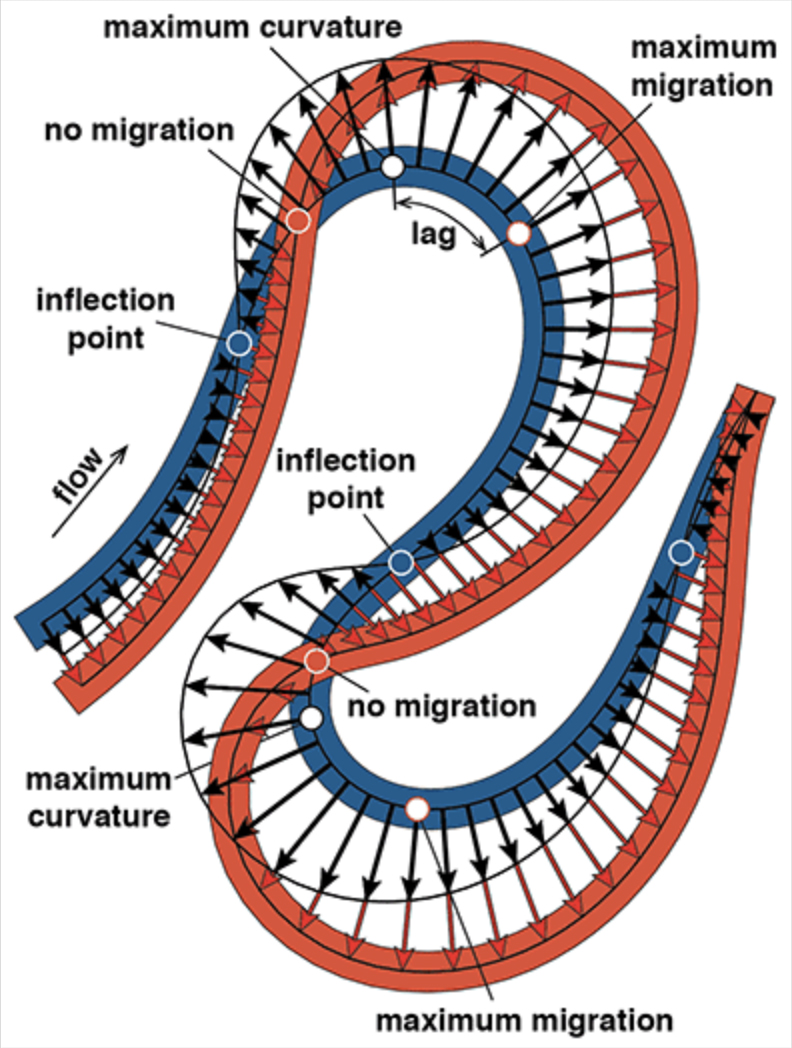
Turns out, the rate of river migration is directly linked to how sharp its bends are.
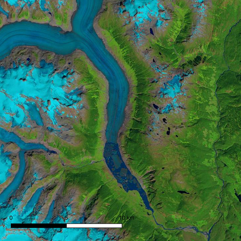
The first comprehensive assessment of glacier mass loss for all regions in western North America (excluding Alaskan glaciers) suggests that ice masses throughout western North America are in significant decline.
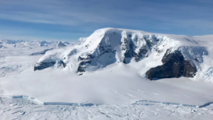
Antarctica experienced a sixfold increase in yearly ice mass loss between 1979 and 2017.
The study used machine-learning to analyze more than 700,000 Landsat images to map changing global distribution of intertidal areas over a 30-year period.
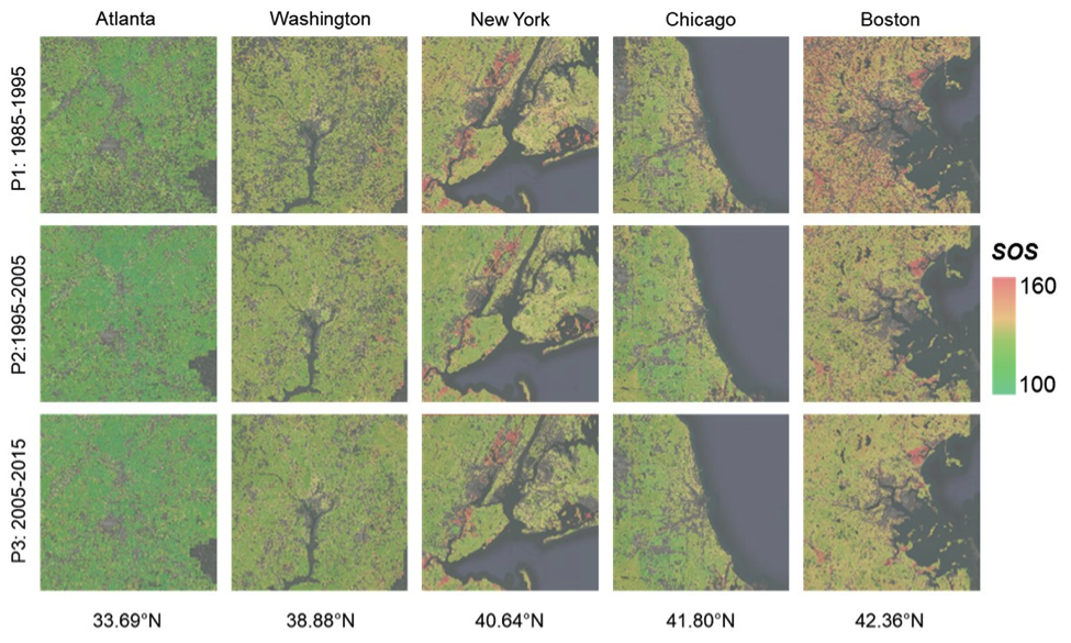
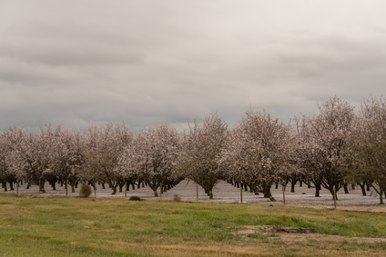
New insights on how vegetation phenology in urban and surrounding areas respond to urbanization.
USGS EROS scientists are leveraging the capability and history of Landsat along with weather data to map landscape-wide water consumption.
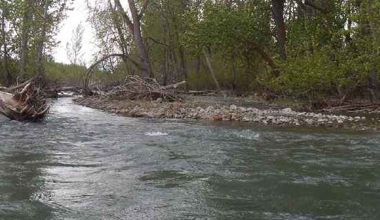
For larger rivers, Landsat provides a rich dataset to define spatiotemporal patterns of channel shifting.
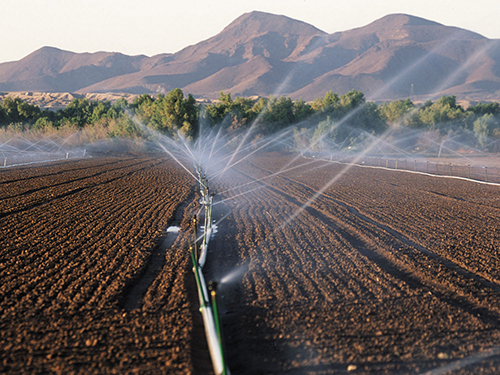
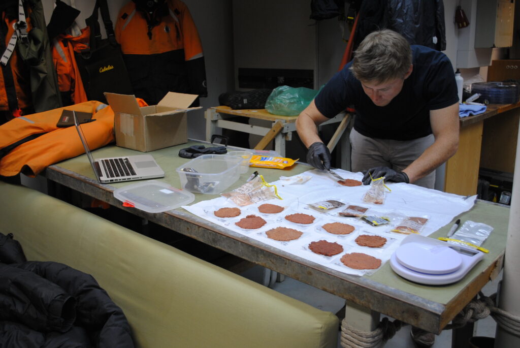
Landsat thermal bands allow for the measurement of water use and moisture status at the management scale.
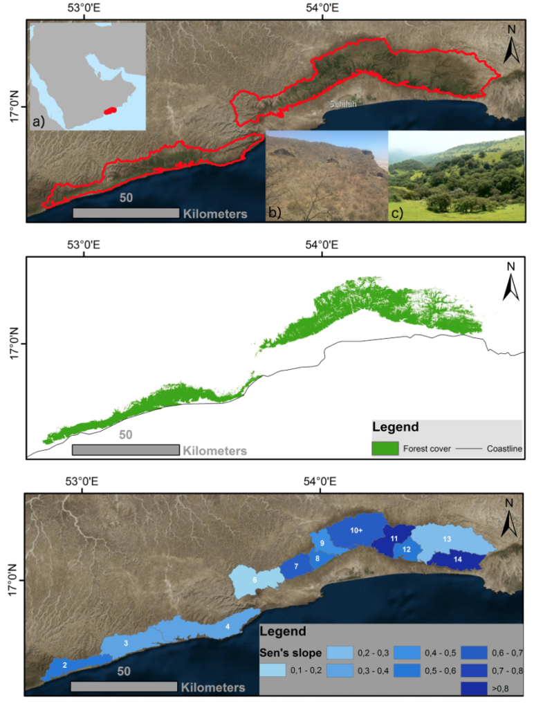
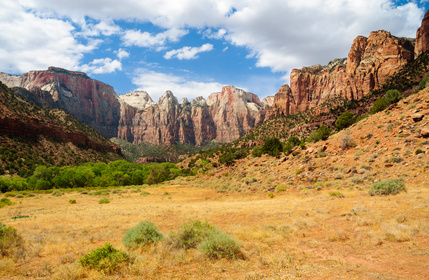
Learn more about this rather unusual seasonal and semi-arid cloud forest.
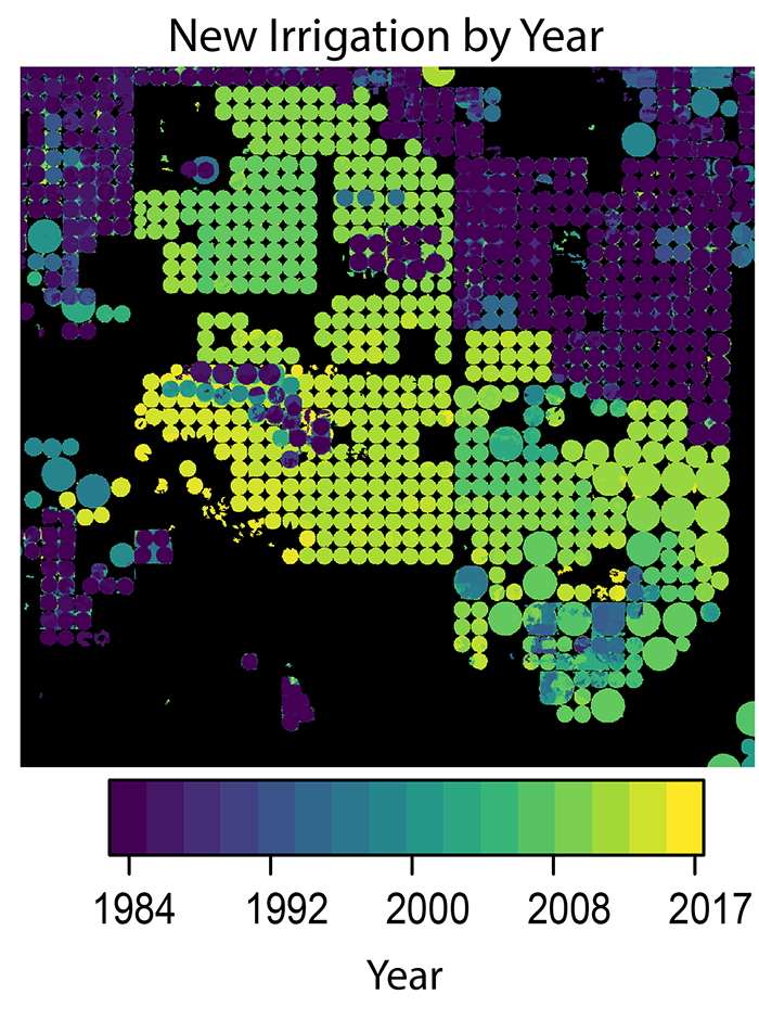
A new method to use the full Landsat archive to produce annual maps of irrigated area over the High Plains Aquifer in the central United States.
Scientists are now able to determine what penguins are eating from space.

Landsat 8 allows for the acquisition of spectral data for monitoring water quality from lakes and drinking water reservoirs across the United States.
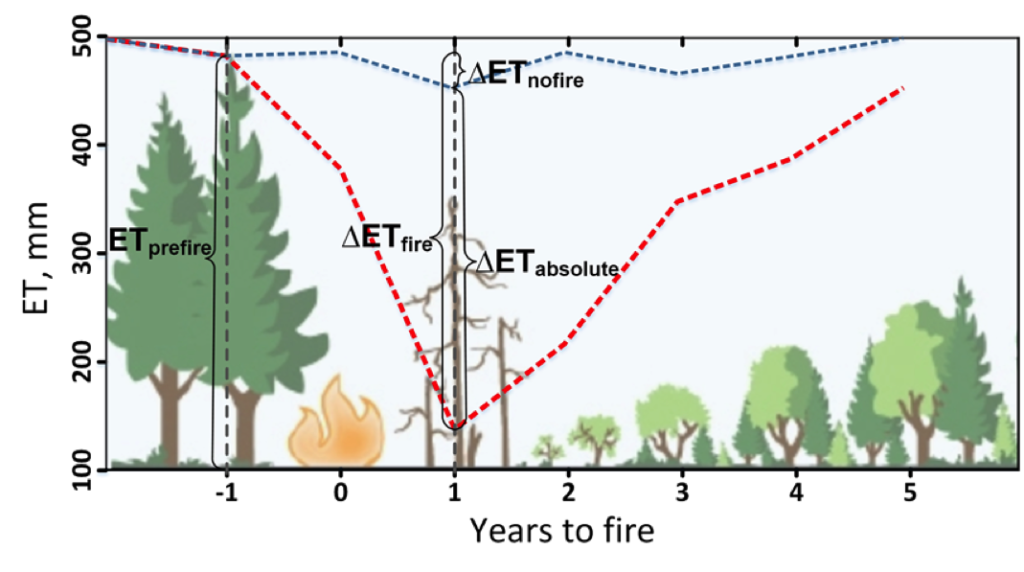
Fires play an important role in regulating forest density, vegetation water use, and runoff.
Stable river islands locally known as ‘chars’ are increasing in the Brahmaputra river.
Following changes in long-term forest health around oil and gas wells in the Pennsylvania State Forest.
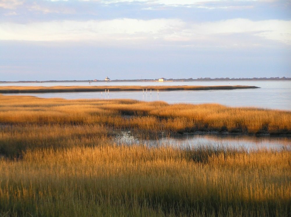
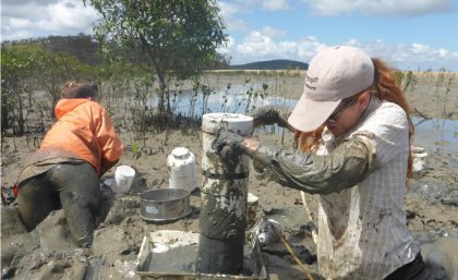
This research identified the Delmarva as an area of significant salt marsh loss over the last three decades.
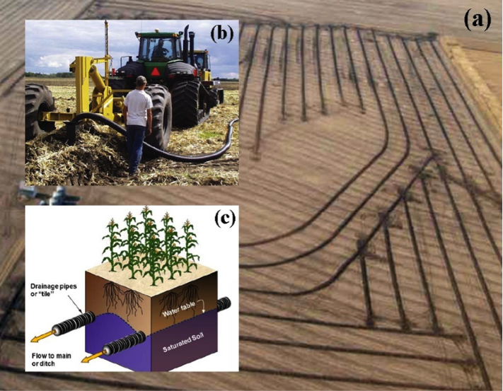
Making annual high-resolution agricultural subsurface drainage maps for the Northern Great Plains regions using multiple satellite and model datasets with Google Earth Engine.
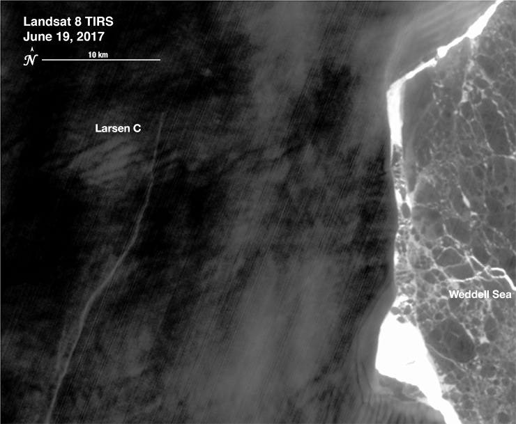
Iceberg A-68 calved from the Larsen C during a period of larger then average tidal cycles.
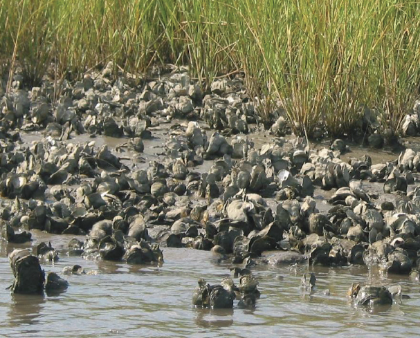
There is evidence of oyster reefs driving estuary-scale detention of freshwater in the Suwannee Sound.
Across the Great Basin from 1984-2016, shrub and grass vegetation are declining.
A robust detection method to track crop cover dynamics and identify the planting year through Landsat time series data.
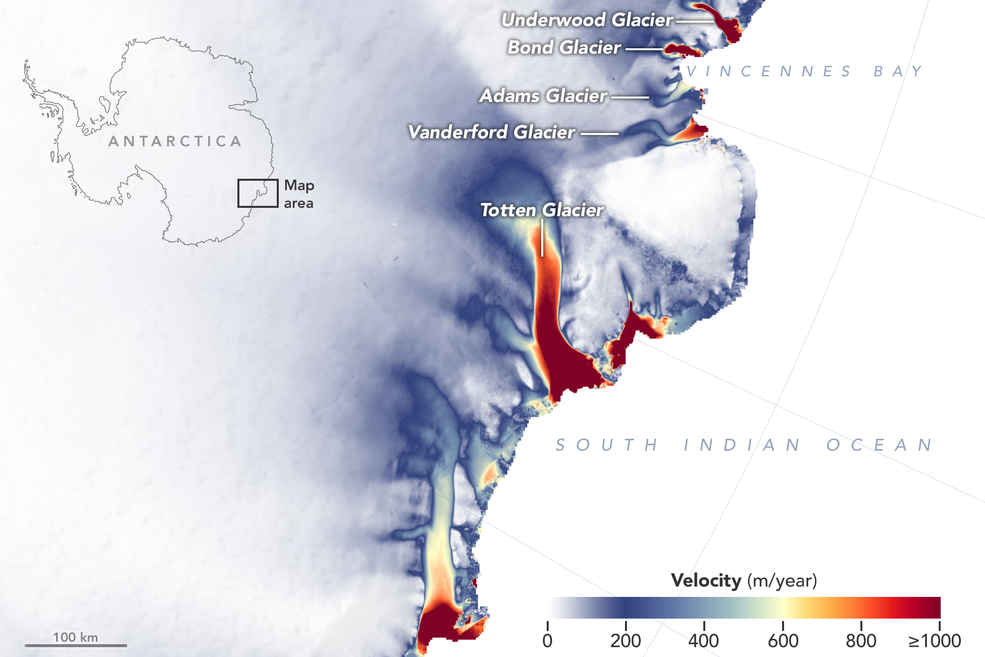
New detailed NASA maps of ice velocity and elevation show that a group of glaciers spanning one-eighth of East Antarctica’s coast have begun to lose ice over the past decade, hinting at widespread changes in the ocean.
