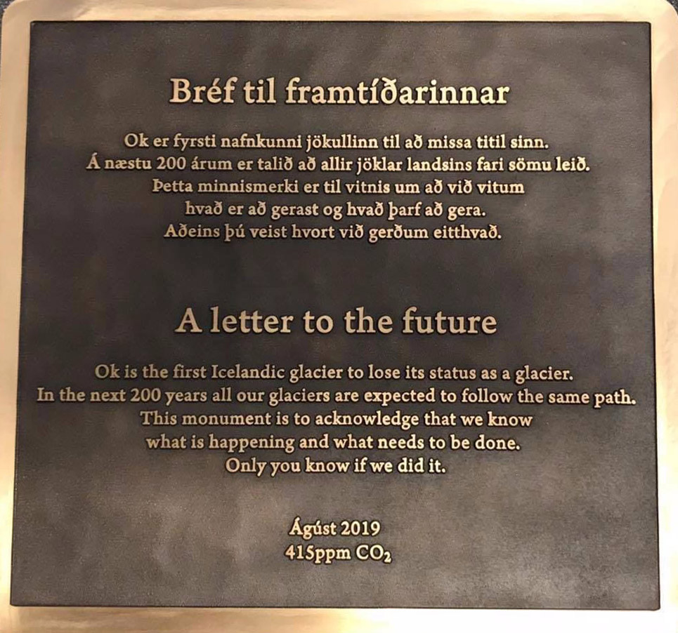
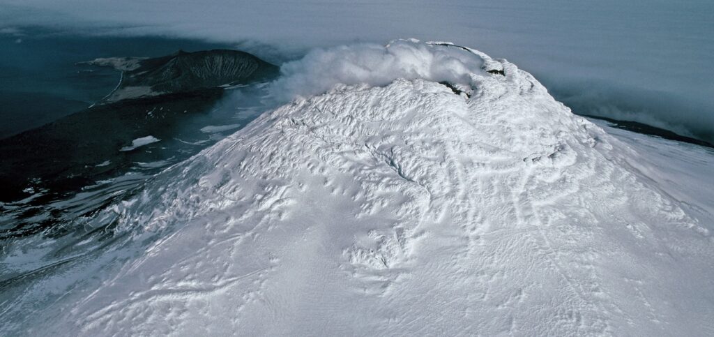
Tribute to a Glacier That Is No More
A memorial was placed on top of the volcano where Okjökull Glacier’s ice once flowed.

A memorial was placed on top of the volcano where Okjökull Glacier’s ice once flowed.
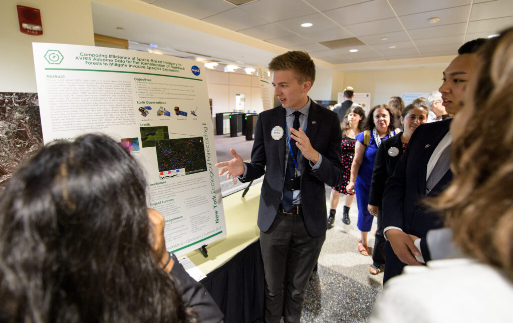
Summer projects focused on using Earth science data for practical applications like agriculture and food security, disasters, ecological forecasting, energy, health and air quality, transportation and infrastructure, urban development and water resources.
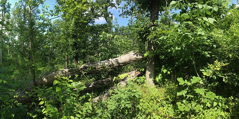
Landsat shows that large blowdown areas in southern Illinois forests are more heavily invaded by invasive species and slower to recover than smaller areas after a tornado.
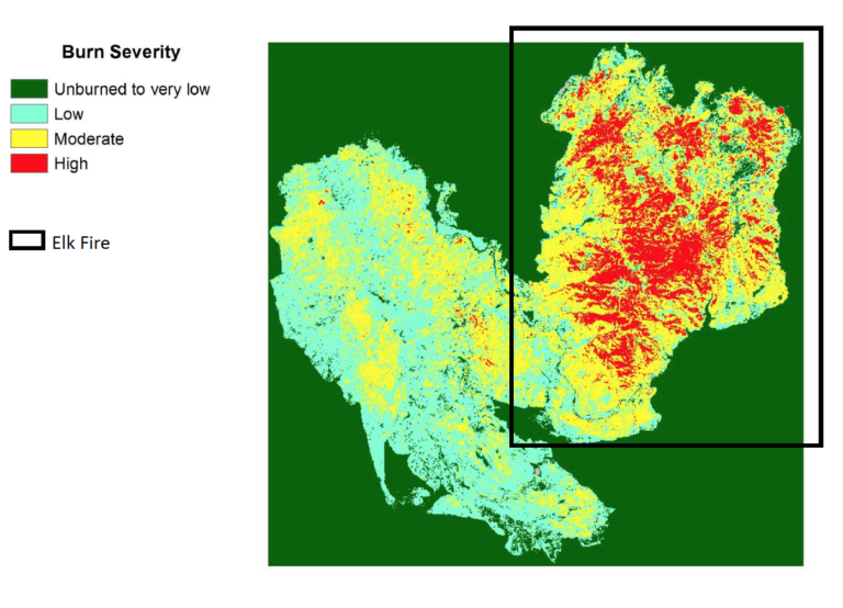
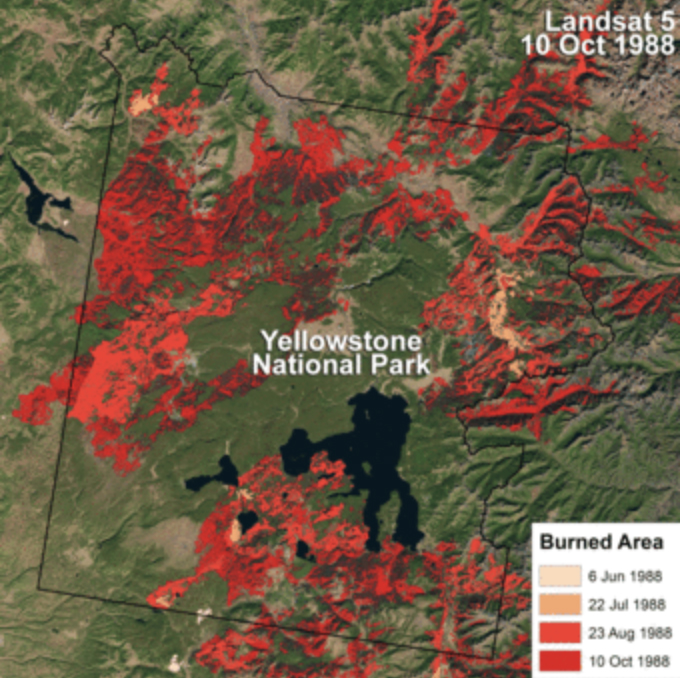
Using satellite imagery is a cost-effective way to assess burned areas and triage mitigation measures post-wildfire, study found. Federal agencies can save as much as $7.7 million annually in post-fire costs by using Landsat.
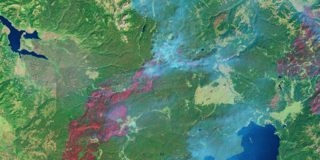
Landsat, Sentinel-2, and ASTER confirm a rare lava lake in Mt. Michael’s crater on the sub-Antarctic Saunders Island—a “remarkable geological feature.”
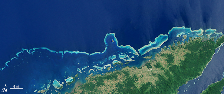
Harnessing 30 years of Landsat data, a team of researchers from Australia has created the first 3D model of Australia’s entire coastline.
With limited resources to dedicate to monitoring for harmful algal blooms, water managers are looking to new technologies from NASA and its partners to detect and monitor potential hazards in lakes and reservoirs.
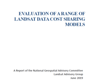
Keeping Landsat data free and open is the right path forward, a federal advisory panel has concluded.
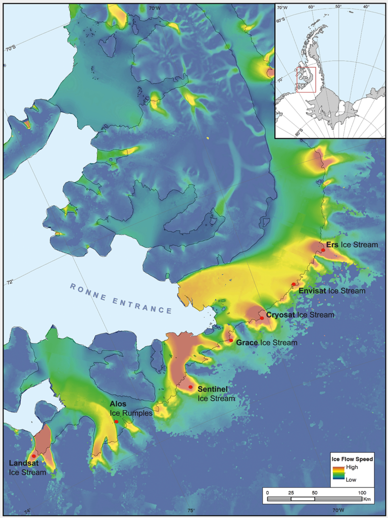
Seven ice features in western Antarctica have been named for Earth-observation satellites, including one named for Landsat.
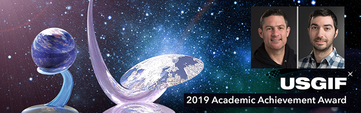
Aaron Gerace and Matthew Montanaro earned the 2019 USGIF Academic Achievement Award for their work on the Landsat 8 TIRS stray-light issue.

Dr. Gao has been awarded in recognition of his original research in the application of remote sensing for crop and vegetation monitoring.
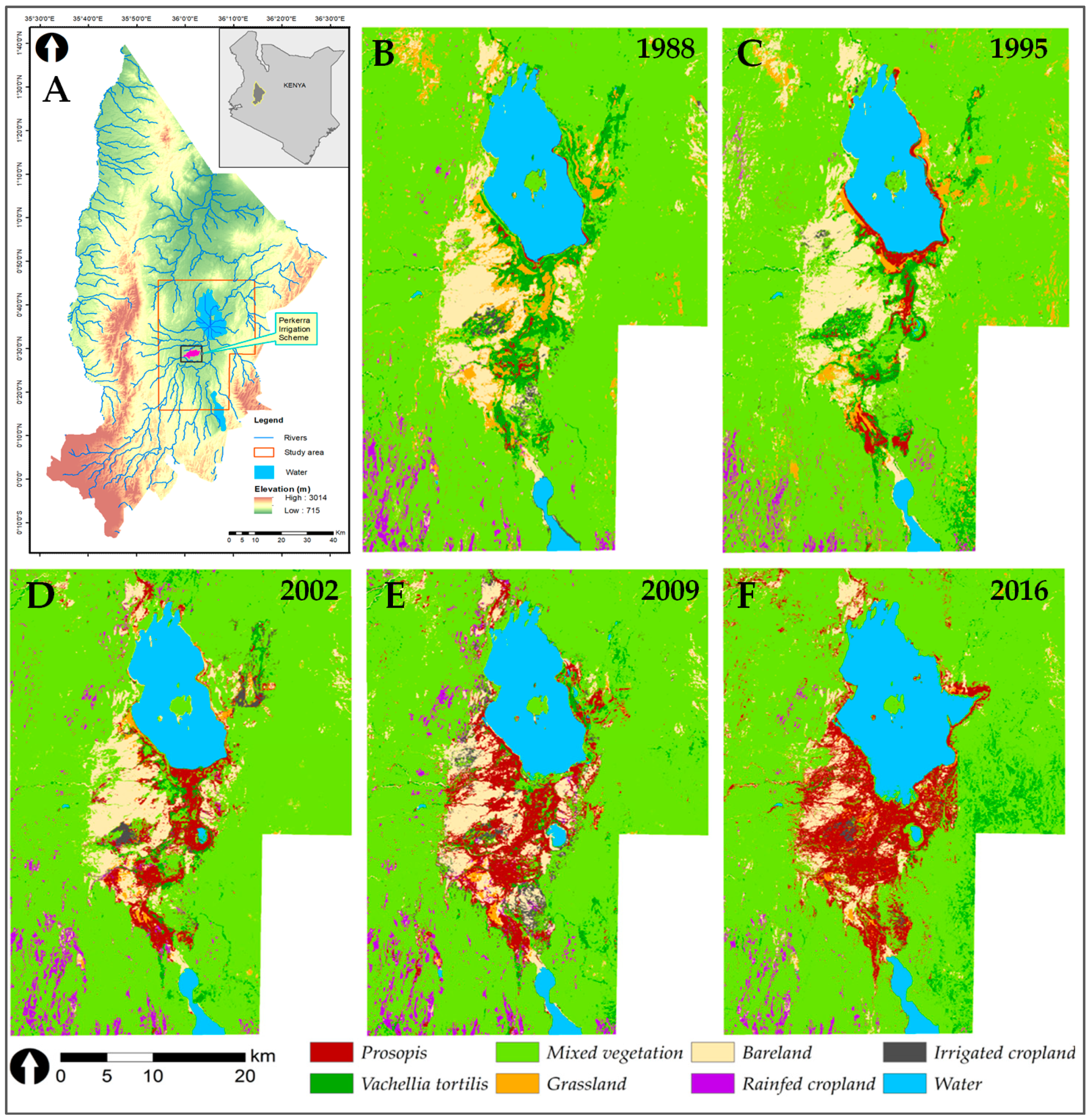
Prosopis was introduced to Kenya in the 1980s to provide fuelwood; it has since turned into an environmental scourge. Landsat has tracked its fast-paced spread.
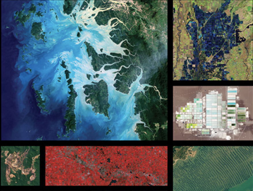
NASA and AmericaView again joined forces to create this year’s 2019 Earth Science Week Poster. The poster features a wide array of remote sensing and geoscience applications.

The prolonged presence of green space is intrinsic for a healthy society a new nationwide Danish study finds.
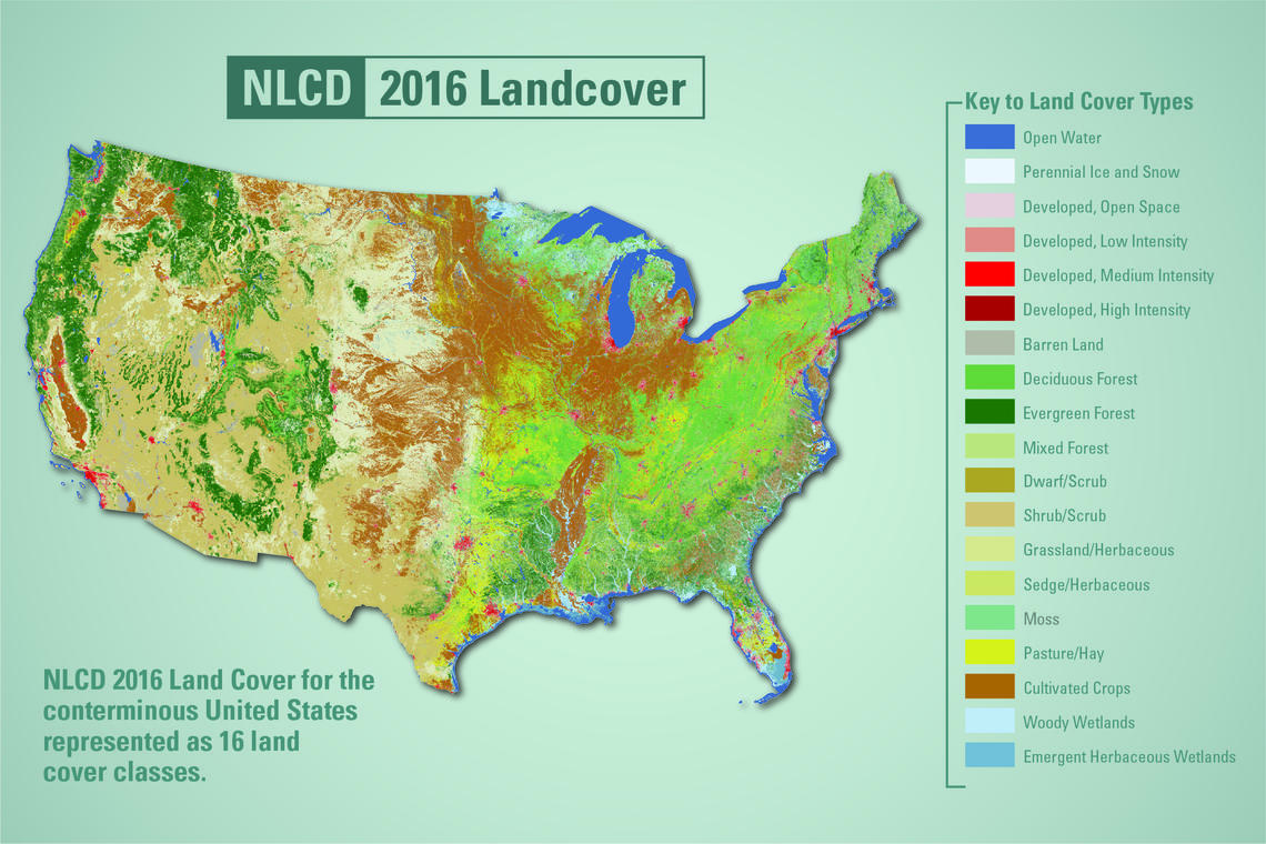
USGS released the latest edition of the National Land Cover Database (NLCD) for the U.S.—the most comprehensive land cover database that the USGS has ever produced.
The USGS is currently finalizing the Landsat Collection 2 product definition structure, production timeline and public availability.
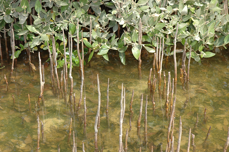
A group of researchers have used Landsat data to help solve a case of missing mangroves in Saudi Arabia’s Jubail Conservation.
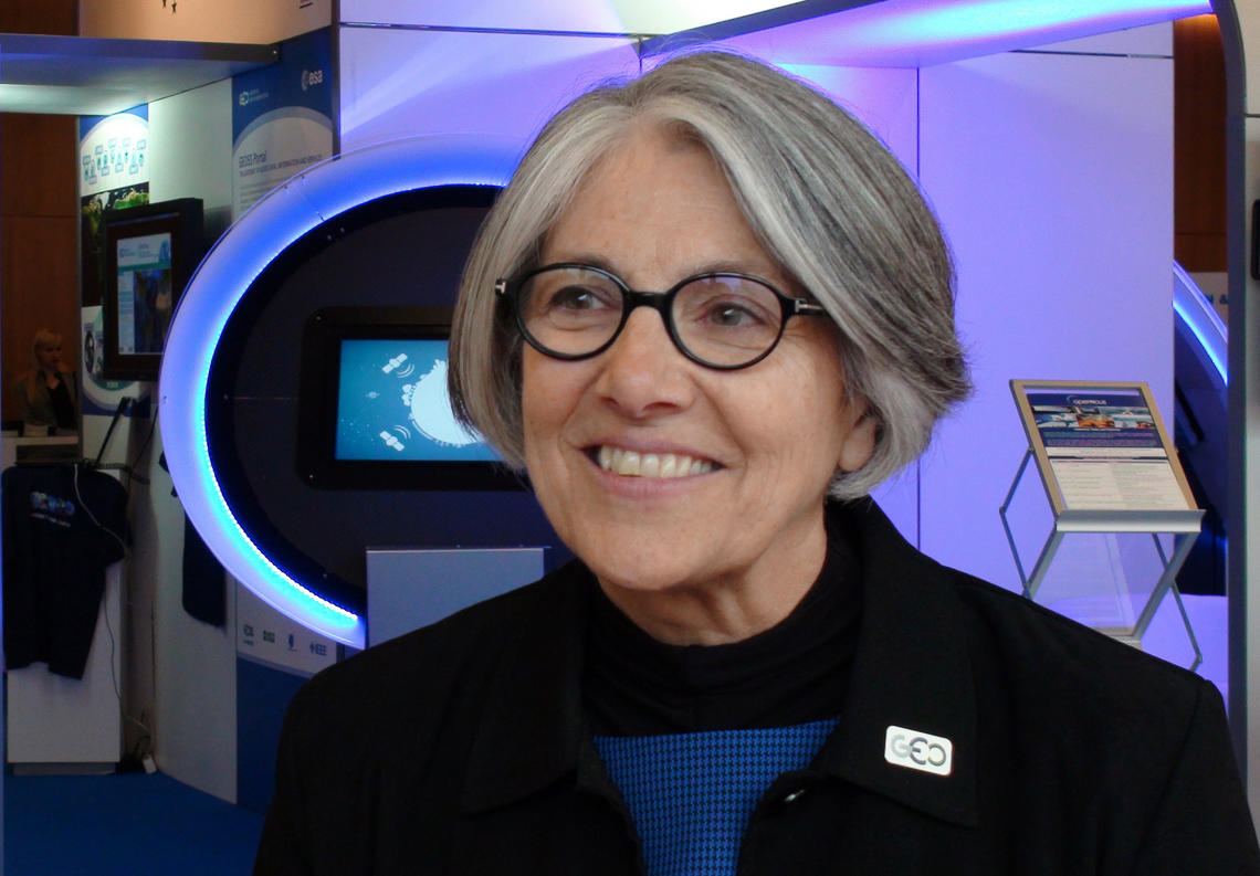
Barb Ryan was recognized with the individual Pecora award for her outstanding contributions as a scientist and visionary leader for advancing the global use of remote sensing through championing data democratization.
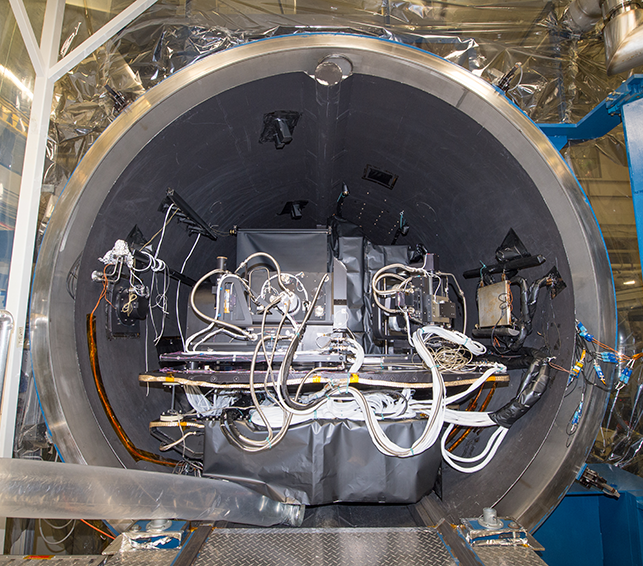
The completion of this test represents a major milestone for the TIRS-2 project, demonstrating that the team has built a well working instrument to meet the requirements of Landsat 9.
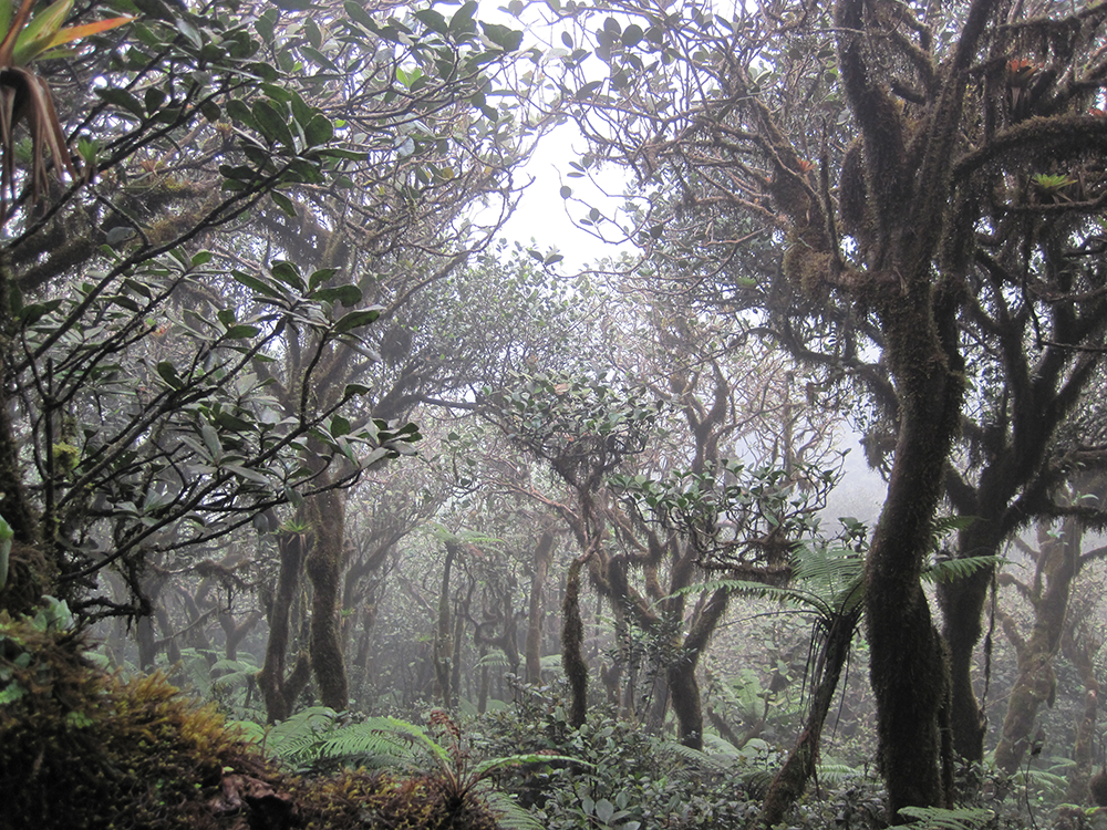
If greenhouse gas emissions continue increasing as they have been, 90% of Western Hemisphere cloud forests would be affected as early as 2060.
In the long and winding history of the Landsat Program, April 15, 1999 was an important day.
Remote sensing scientists now can access a decades-long Landsat look at how specific conditions have played out on every applicable 30-meter pixel of the American landscape.
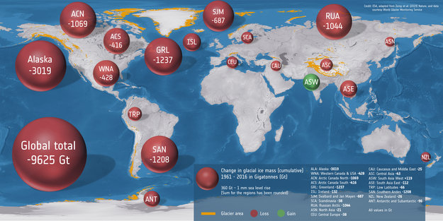
An international team used classical glaciological field observations combined with a wealth of information from various satellite missions to painstakingly calculate how much ice has been lost or gained by 19 different glacierized regions around the world.
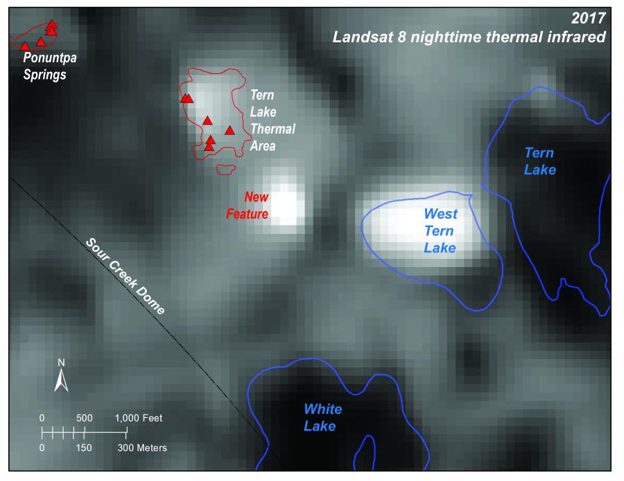
Over the last 20 years, a new thermal area has developed in Yellowstone. Landsat 8 is on the case.
It started as an algorithm to detect clouds in satellite imagery, but now the software is being used for everything from increasing food security in the developing world to guiding futures trading on Wall Street.
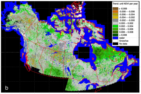
The Arctic-Boreal Vulnerability Experiment (ABoVE) field campaign has released data of the summer NDVI trend and trend significance for 1984 to 2012 over Alaska and Canada.
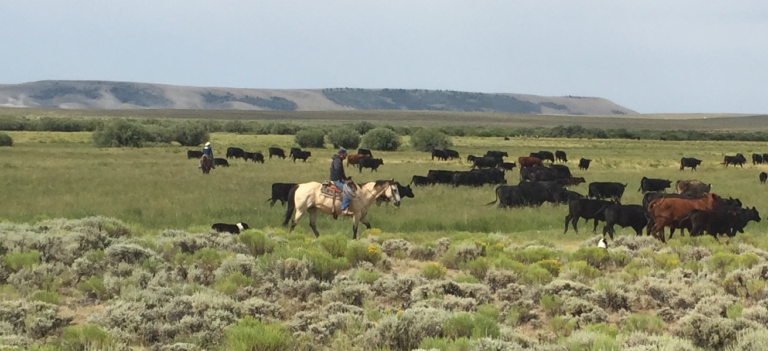
The Landsat-based Rangeland Analysis Platform and Green-Cast are valuable tools for ranchers adaptively managing their land.
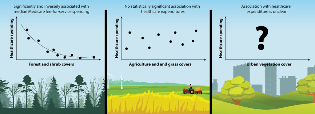
Each 1 percent of a county’s land that was covered in forest was associated with an average Medicare expenditure savings of $4.32 per person per year.
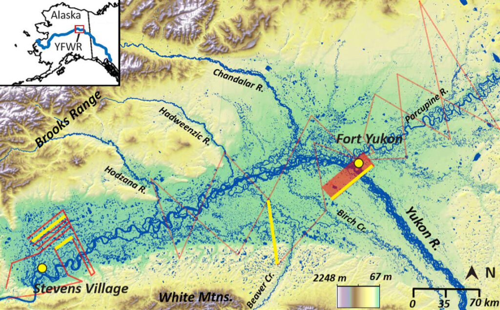
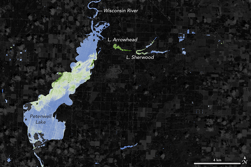
Remarkably little is known about the subsurface connections between the thousands of lakes scattered across ecoregions like Yukon Flats; this study sheds light on those lakes.
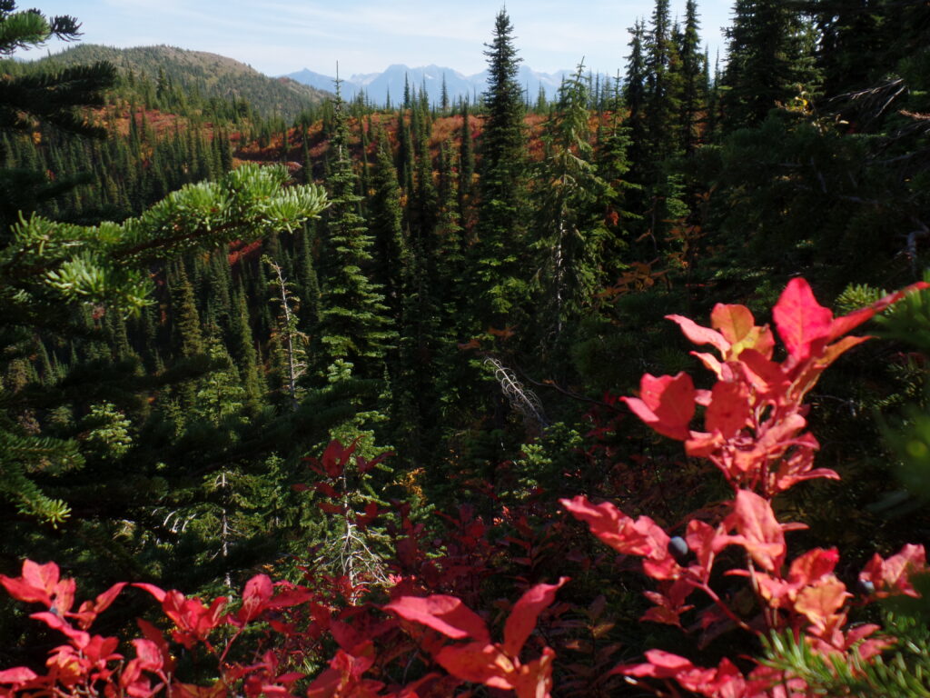
A Landsat-based approach to map huckleberry distribution across Glacier National Park could one day provide warnings of potential human-bear conflict areas.
NASA ARSET is putting on an advanced webinar focused on time series image analysis.
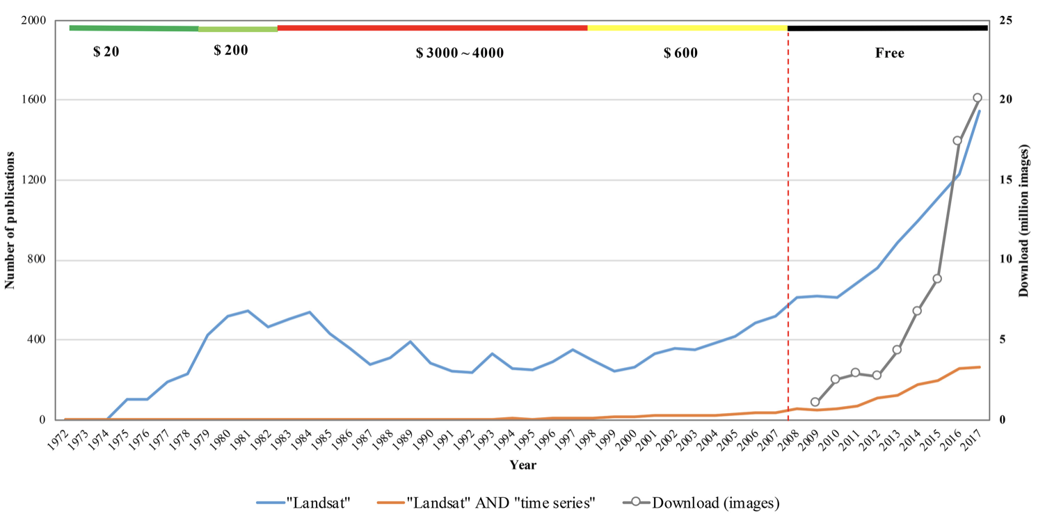
The resounding takeaway from a recent paper authored by Landsat Science Team members: Keep Landsat data free and open.
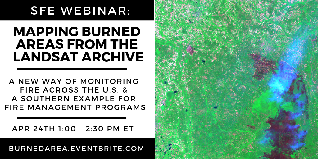
Learn about the Landsat Burned Area algorithm that identifies burned areas in dense time-series of Landsat data.
