Reading the Landscape
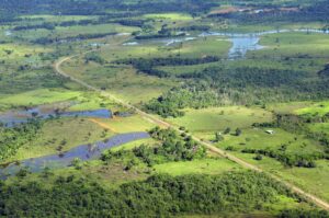
More than 100 countries at the UN Climate Change Conference this past year made the bold commitment to halt and reverse deforestation by 2030.

More than 100 countries at the UN Climate Change Conference this past year made the bold commitment to halt and reverse deforestation by 2030.
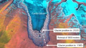
A new mapping tool developed by UNBC researchers shows that western Canadian glaciers are shrinking at an increasing rate.
Launched September 27, Landsat 9 will provide a high-quality and reliable stream of land imaging data for the next 10-plus years.
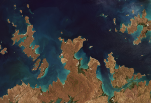
Using decades of Landsat satellite imagery, scientists at Geoscience Australia have mapped annual shoreline locations for the entirety of Australia going back more than thirty years.
The World Settlement Footprint is the world’s most comprehensive dataset on human settlement.
Data from Landsat powers OpenET, a new web-based platform that puts water use information for 17 western United States into the hands of farmers, water managers and conservation groups.
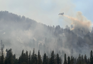
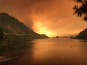
Wildfires in the western United States have been spreading to higher elevations over the past few decades due to warmer and drier conditions that are clearly linked to climate change.
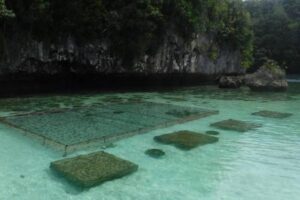
In Micronesia, the nation of Palau is building sustainable aquaculture farms in the ocean with the help of satellites.
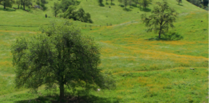
California’s blue oak woodlands have decreased by more than 1,200 square kilometers.
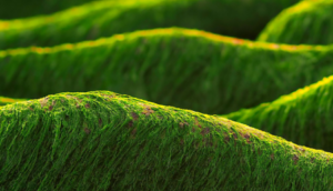
‘Green tides’ of algae have wreaked havoc across the coastlines of Brittany, France, for half a century due to high levels of agricultural runoff. With efforts to reduce these underway, a new technique using over three decades of satellite images highlights the extent of the continuing problem.
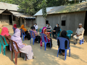
Putting NASA and USGS satellite information at farmers’ fingertips leads to less water use and better crop yields in South Asia.
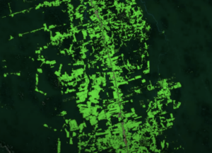
Scientists use Landsat to track changing patterns of deforestation that tells them how Amazonian agricultural practices have changed, from small family holdings to massive ranching operations.
Justin Braaten is a code wizard, helping everyone from wildlife ecologists to machine learning experts more easily use Landsat.
The Liberian government, with the help of NASA and Conservation International, is using Landsat and GEDI data to estimate the country’s natural capital.

Australia’s natural resource regulator uses drones and satellite imagery to monitor water use and compliance with their water laws across New South Wales to ensure our water resources are protected for generations to come.
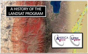
UtahView’s Ellie McGinty has created a Google Earth Web Map showcasing Landsat’s history.
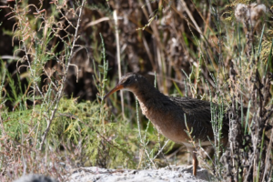
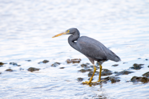
By Morgan Spehar, NASA’s Goddard Space Flight Center The Yuma Ridgway’s rail, a chicken-sized bird that looks like a cross between a duck and a crane,
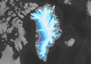
Many of the Greenland’s glaciers are retreating while also undergoing other physical changes.
Using satellite images to track global tundra ecosystems over decades, a new study found the region has become greener, as warmer air and soil temperatures lead to increased plant growth.
A new study reports a net increase of 5.38 petagrams of forest biomass between 1984 and 2016; carbon-wise, that is equivalent to a train of loaded coal cars long enough to wrap itself around Earth nearly 34 times.

In August 1975, Jacques Cousteau and his divers helped determine if Landsat could measure the depth of shallow ocean waters.
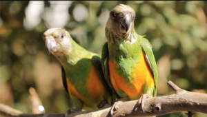
This bird’s-eye view of the relationship between temperature and bird biodiversity will help conservationists figure out where to prioritize their efforts in a warming world.
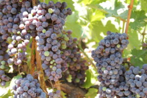
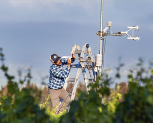
Grape growers like Gallo are using data from Earth-observing satellites to better track soil and vine moisture levels, understand vine water use and plan grapevine irrigation.
How the fields of epidemiology and remote sensing intersect to help the public.
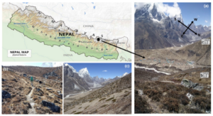
Plant life is expanding in the area around Mount Everest, and across the Himalayan region, new research shows.
Fires in forested watersheds that support drinking water supplies can introduce contaminants that overwhelm current treatment capabilities. Earth observation data are helping.

At the 2019 AGU Fall Meeting, over 500 presentations feature research conducted with the aid of Landsat data.

This month, TIRS-2 successfully passed the stringent 12-week testing process at NASA’s Goddard Space Flight Center and was shipped to Northrop Grumman’s facility in Arizona.
Harnessing 30 years of Landsat data, a team of researchers from Australia has created the first 3D model of Australia’s entire coastline.
Keeping Landsat data free and open is the right path forward, a federal advisory panel has concluded.

The prolonged presence of green space is intrinsic for a healthy society a new nationwide Danish study finds.
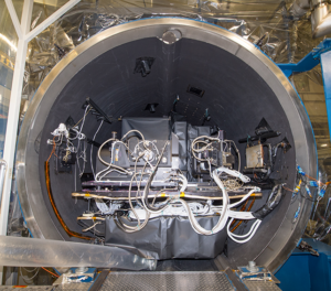
The completion of this test represents a major milestone for the TIRS-2 project, demonstrating that the team has built a well working instrument to meet the requirements of Landsat 9.
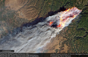
Sprawling urban fires that once plagued civilization were thought to be a thing the past—the Camp Fire let us know they are back.
