![STELLA-logo STELLA logo](https://landsat.gsfc.nasa.gov/wp-content/uploads/elementor/thumbs/STELLA-white-q1h8hkv9yhtnbhzz7ygsf2wdbpwsfrg4ilpltsay22.png)
The STELLA (Science and Technology Education for Land/Life Assessment) project uses instruments that can be built with low-cost components and 3D printed housings to introduce NASA Earth observation technologies and provide authentic learning experiences for remote sensing education.
STELLA Instruments
![STELLA Spectrometers 1.1, Q2, 2.0, Q](https://landsat.gsfc.nasa.gov/wp-content/uploads/2024/05/STELLA_continuum-1024x422.png)
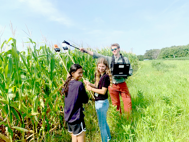
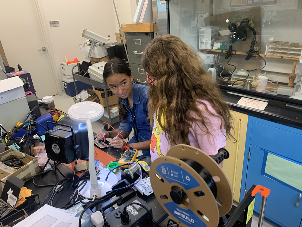
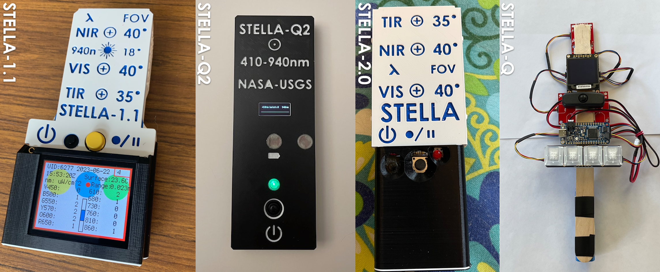
There are 3 types of STELLA instruments that can take measurements about the Earth’s environment.
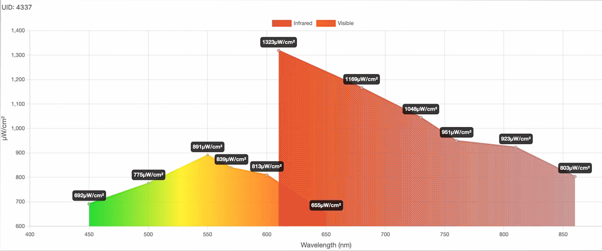
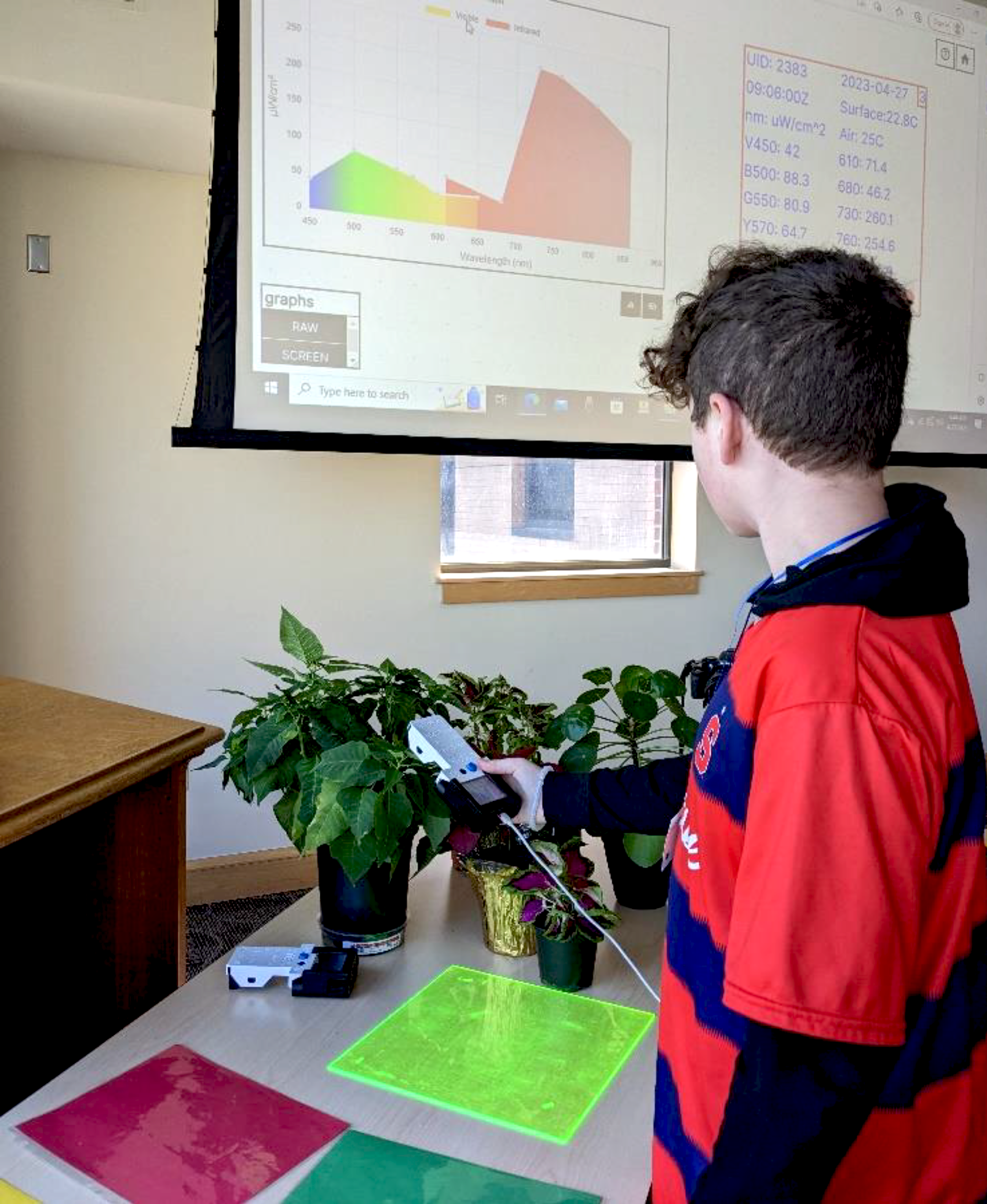
- STELLA spectrometers measure energy across the visible and infrared portion of the electromagnetic spectrum, similar to measurements observed by the Landsat satellite. Data can be displayed using the STELLA-Dataviewer and analyzed to demonstrate how spectral data reveals information about our physical environment beyond what we can see such as vegetation health, moisture content, or mineral composition.
![The STELLA-Dataviewer cycling through data](https://landsat.gsfc.nasa.gov/wp-content/uploads/2024/05/DataviewerMov_try2.gif)
- The STELLA AQ (air quality) instrument provides the ability to gauge ambient air quality by measuring carbon dioxide (CO2) and particulate matter (PM).
- The Helio-STELLA instrument measures incoming solar radiation throughout the visible light and Ultraviolet-A (UVA) spectrum, and is useful for understanding how radiation intensity varies across time and space.
STELLA for Outreach
The inspiration for the creation of the STELLA spectrometer line of instruments is Landsat. Using STELLA as an analog to Landsat you can show in real-time incoming measurements of reflected light and get across some of the basics about how and why Landsat and other highly accurate and precise remote sensing instruments benefit us.
Showing the difference in the near-infrared measurements between a healthy leaf and a dead or dying leaf and explaining why that’s important to agriculture and forestry is a simple and effective entry point to engage the audience’s curiosity.
![Michael Taylor (left) discusses Landsat and spectral signatures with NASA Headquarters employees including Bill Nelson, the NASA Administrator (second from left).](https://landsat.gsfc.nasa.gov/wp-content/uploads/2024/04/EarthDay1-768x454.jpg)
STELLA for Education
STELLA introduces students to foundational remote sensing concepts by enabling them to build their own handheld instruments and use them to collect real-time measurements of reflectance from surfaces as well as measurements of air quality and incoming solar radiation. By building their own instruments, students learn first-hand about mechanical and electrical engineering concepts such as sensor assembly and light detection.
Students also learn about calibration concepts through the process of ensuring consistent and precise measurements from their STELLAs, and can learn basic programming skills by writing code to ingest and analyze the data.
STELLA for the Community
STELLA spectrometers provide users the ability to capture point-based reflectance observations in the visible (VIS) and near infrared (NIR) bands as well as temperature estimates from the thermal infrared (TIR) band over a variety of urban and vegetated land cover surface targets such as asphalt, bare soil, and grasslands.
STELLA reflectance data was measured against data collected in-situ from an ASD (Analytical Spectral Device) spectrometer using a white panel target under consistent light and target-sensor-illumination geometry conditions. Under these conditions, no significant differences in uncertainty were observed between the two data sources. Generally, the standard deviation of the data vary between 8-18% while the standard errors were found in the range of 3-6%, with the VIS bands having lower uncertainties than those in the red-edge and NIR bands.
While it is easy to obtain consistent measurements of reflectance from short and uniform canopy surface targets, limitations currently exist when collecting data over surfaces with heterogeneous texture properties and vertical canopy structure (e.g. tall corn and forest canopies), as an increase in uncertainty is associated with an increase in canopy height and spatial diversity. To obtain accurate reflectance time-series measurements, properties of the target land cover must be considered and care must be taken to ensure consistent target-sensor-illumination geometry and light levels between measurements.
* Any use of trade, firm, or product names is for descriptive purposes only and does not imply endorsement by the U.S. Government.