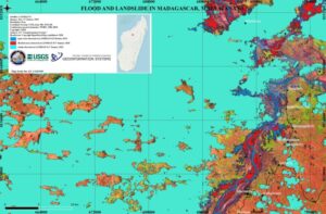
Mapping it Out: Flooding & Landslides in Madagascar
Landsat continues to support the International Disaster Charter.

Landsat continues to support the International Disaster Charter.
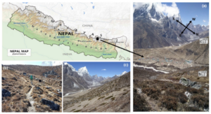
Plant life is expanding in the area around Mount Everest, and across the Himalayan region, new research shows.
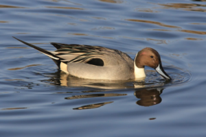
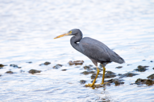
Ecologists are using Landsat to locate waterbird habitat that may be vulnerable in dry years.

Landsat-based urban extent and phenology indicators provide new information about urban environments.
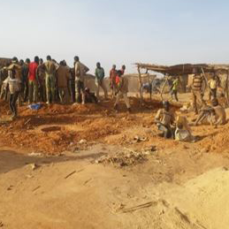
Landsat helps monitor changes in artisanal gold mining areas, enabling land managers to prevent and remedy environmental impacts.
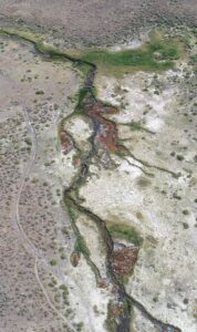
There is a dance between the vegetation that thrives along a river’s edge and the availability of water; with Landsat, that relationship is now being understood in ways not previously possible.
IndigoAg is using HLS data to help fulfill its mission of making farms more profitable and sustainable.
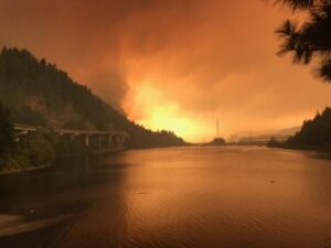
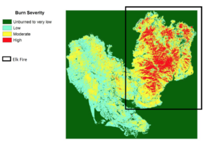
Fires in forested watersheds that support drinking water supplies can introduce contaminants that overwhelm current treatment capabilities. Earth observation data are helping.
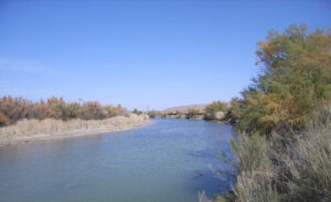
New Mexico is one of the most arid states in the US, and precise and accurate information on water use is of utmost importance.
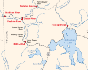
Landsat is among the resources that scientists are using to assess hazards and track volcanic activity in Yellowstone.
Southwest Banks Island has experienced the deleterious effects of climate change.
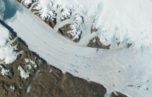
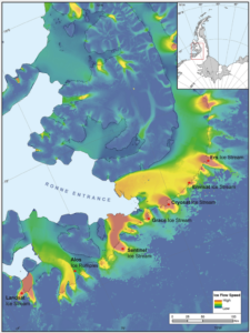
By Laura E.P. Rocchio December 11, 2019 • Dr. Christopher Shuman is a glaciologist with NASA Goddard Space Flight Center and the University of Maryland at
Landsat helped confirm and quantify what was only anecdotally known before: beaver dams make wetlands uniquely resistant to wildfires.
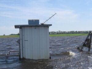
Landsat has enabled a more thorough understanding of how the Central Valley landscape is impacted by floods.
Remote sensing can aid the monitoring and evaluation of incentivized farming programs like the one in Maryland.
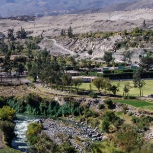
Landsat has helped map the expansion of intensive agriculture in arid Arequipa, Peru.
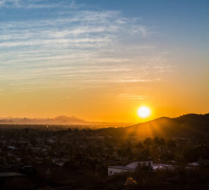
Socio-economically vulnerable populations are at a higher risk of experiencing urban heat effects.
New time-lapse videos of Earth’s glaciers and ice sheets as seen from space are providing scientists with new insights into how the planet’s frozen regions are changing.
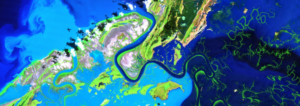
A new longitudinal study from Australia has harnessed thirty years of NASA/USGS Landsat data to map the nationwide movement and migration of mangrove forests.
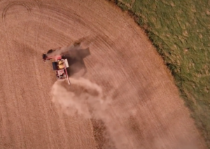
Farmers across the Midwest are in a race to finish harvesting their corn, soybean, and other staples of the Thanksgiving dinner table before the first crop killing freeze sets in.
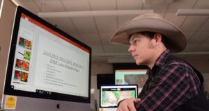
Wyoming students in the College of Agriculture and Natural Resources are using Landsat images to gauge and improve lands owned by their families.
The intensity of summer algal blooms has increased over the past three decades, according to a first-ever global survey of dozens of large, freshwater lakes.

A new investigative report published by NPR has found that it’s hotter in cities’ low income areas.
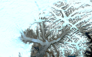
The branching network of glaciers that empty into Greenland’s Sermilik Fjord has changed significantly in the last half century.
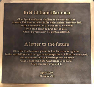
A memorial was placed on top of the volcano where Okjökull Glacier’s ice once flowed.
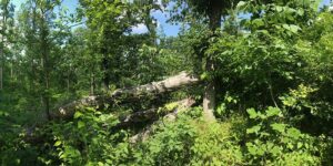
Landsat shows that large blowdown areas in southern Illinois forests are more heavily invaded by invasive species and slower to recover than smaller areas after a tornado.
Using satellite imagery is a cost-effective way to assess burned areas and triage mitigation measures post-wildfire, study found. Federal agencies can save as much as $7.7 million annually in post-fire costs by using Landsat.
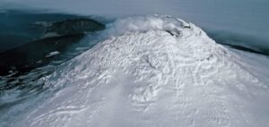
Landsat, Sentinel-2, and ASTER confirm a rare lava lake in Mt. Michael’s crater on the sub-Antarctic Saunders Island—a “remarkable geological feature.”
Harnessing 30 years of Landsat data, a team of researchers from Australia has created the first 3D model of Australia’s entire coastline.
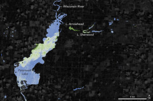
With limited resources to dedicate to monitoring for harmful algal blooms, water managers are looking to new technologies from NASA and its partners to detect and monitor potential hazards in lakes and reservoirs.
Seven ice features in western Antarctica have been named for Earth-observation satellites, including one named for Landsat.
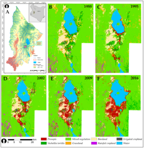
Prosopis was introduced to Kenya in the 1980s to provide fuelwood; it has since turned into an environmental scourge. Landsat has tracked its fast-paced spread.

The prolonged presence of green space is intrinsic for a healthy society a new nationwide Danish study finds.
